Mining Surveys
Mining Surveys
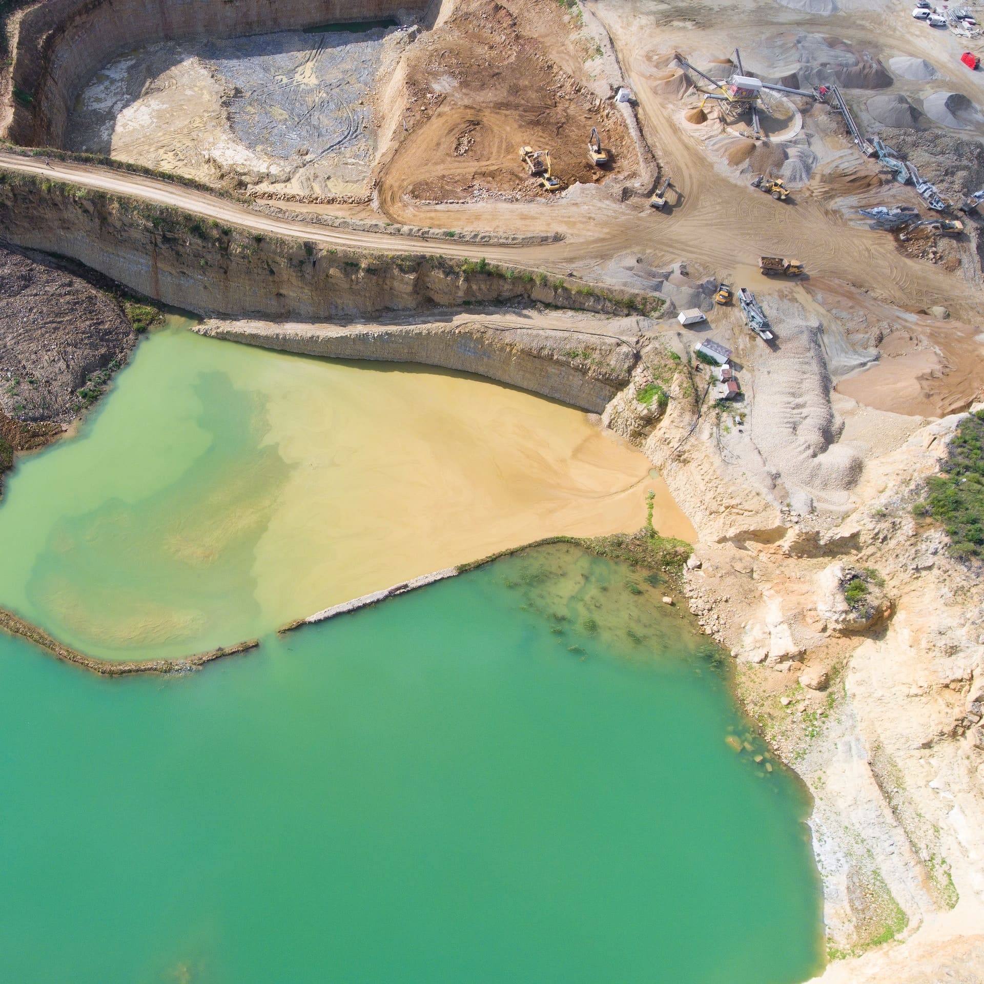
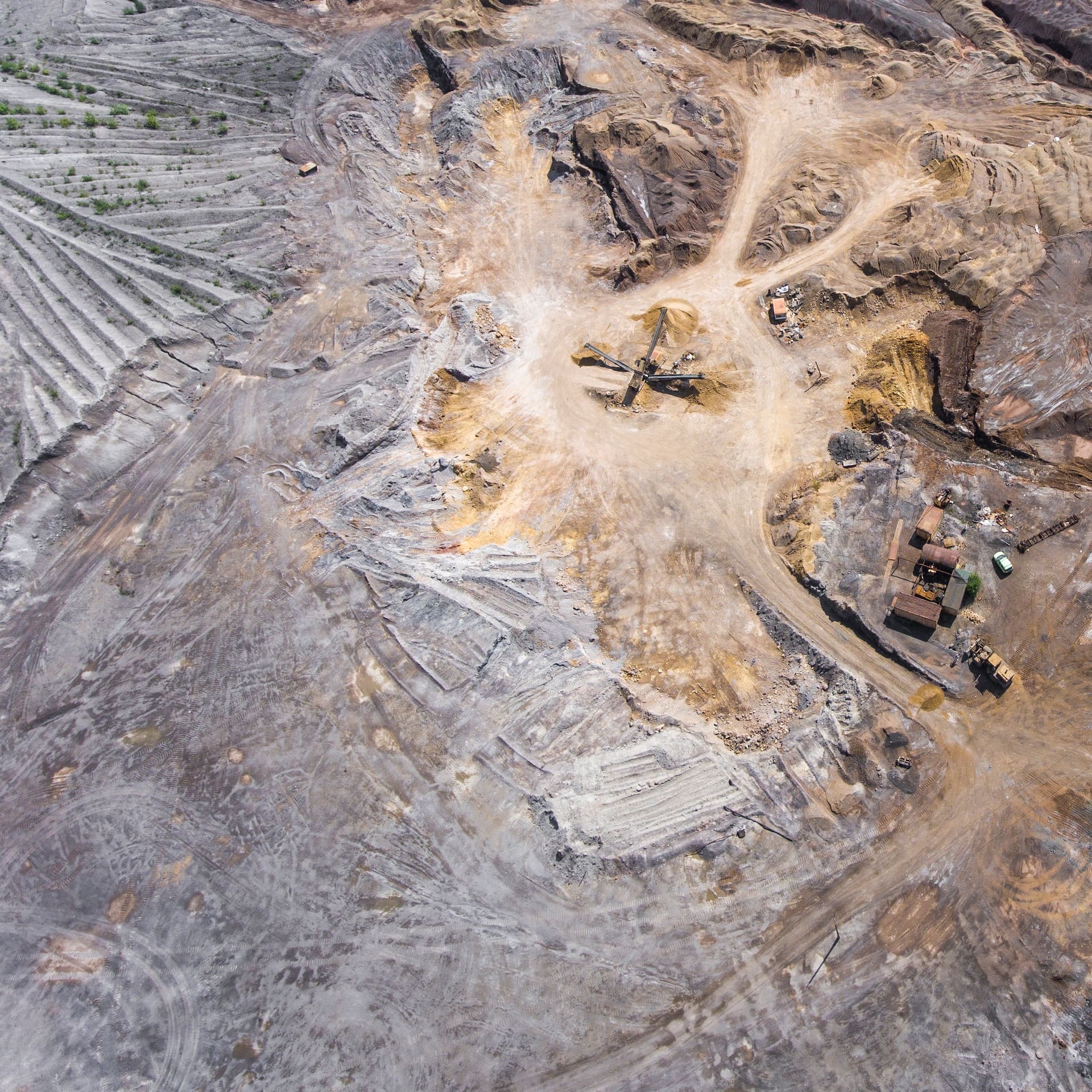
Mining surveys are used to map out mines and identify potential hazards. These surveys include a thorough visual inspection of the mine, as well as a drone inspection to get a closer look at hard-to-reach areas.
Mining surveys can be used to:
Safety and Risk Assessment:
Mining surveys help identify potential hazards, such as unstable ground conditions, underground water sources, or geological faults. By understanding these risks, mining companies can develop appropriate safety measures to protect workers and equipment.
Compliance and Regulation:
Mining surveys provide data necessary for complying with regulatory requirements and obtaining permits. Accurate and comprehensive survey information ensures that mining activities adhere to environmental, health, and safety standards.
Resource Modeling:
The data collected during a mining survey can be used to create 3D geological models, enabling mining engineers to visualize and analyze the distribution of mineral resources in the deposit accurately.
Mine Planning:
Mining survey data helps in designing the layout of mining operations, including pit locations, access roads, and infrastructure placement.
If you're a mining company, you should consider getting mining surveys once to twice a year. Mining surveys are a relatively inexpensive way to protect your workers and to improve safety.
Additional Information
Our drone services offer comprehensive solutions for the mining industry, assisting mining companies in various aspects of their operations. With our advanced aerial technology and data processing capabilities, we provide valuable insights, cost savings, and improved safety for mining operations.
One of the key applications of drones in the mining industry is aerial surveys and mapping. By conducting high-resolution aerial surveys, we generate accurate and up-to-date maps of mining sites, including topography, land use, and potential resource areas. These maps assist in planning mining activities, identifying exploration targets, and optimizing operational efficiency.
Furthermore, our drones can be equipped with specialized sensors, such as LiDAR (Light Detection and Ranging) or multispectral cameras, to capture detailed data on geological formations, vegetation health, or environmental parameters. This data helps mining companies assess potential risks, plan for reclamation efforts, and monitor the impact of mining activities on the surrounding environment.
Another crucial application of drones in the mining industry is stockpile measurement. Traditional methods of stockpile measurement can be time-consuming, labor-intensive, and prone to errors. However, with our drone services, we can quickly and accurately measure stockpiles of minerals, aggregates, or other materials using photogrammetry techniques. This enables mining companies to track inventory, optimize material usage, and ensure accurate billing and reporting.
Additionally, our drones play a vital role in mine inspections and safety assessments. They can access difficult-to-reach areas, such as steep slopes, high walls, or hazardous zones, without putting human inspectors at risk. By capturing high-resolution imagery and video footage, we help identify potential safety hazards, monitor structural integrity, and ensure compliance with safety regulations.
Overall, our drone services provide mining companies with valuable data, insights, and efficiencies that contribute to operational excellence. From aerial surveys and mapping to stockpile measurement and safety inspections, our advanced aerial technology and experienced team support mining operations in optimizing productivity, reducing costs, and promoting sustainable practices.
Follow us
©Copyright 2023 Florida Drone Pros. All Rights Reserved