Construction Site Modeling
Construction Site Modeling
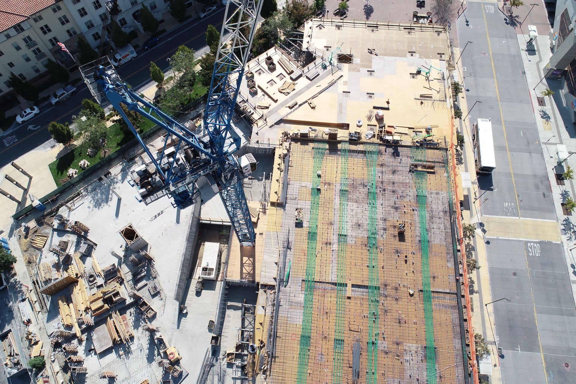
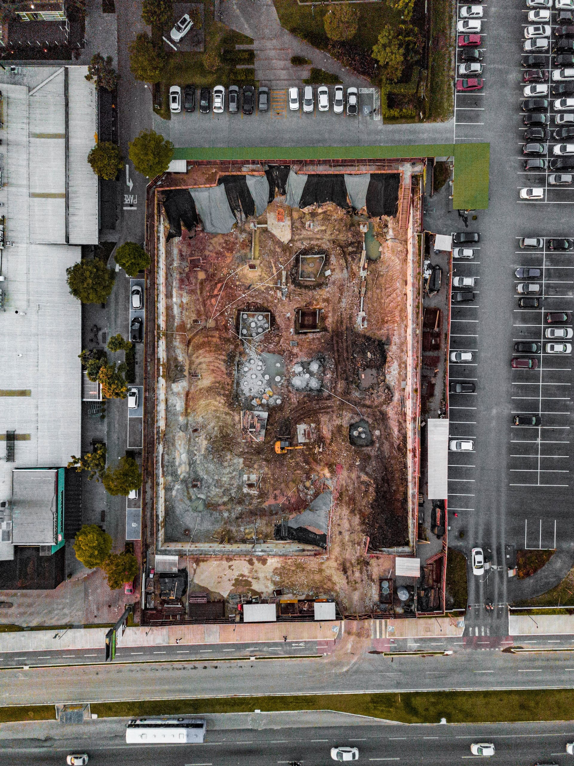
Construction site modeling is used to visualize construction projects before they're even built. These models are created using drone footage and 3D laser scanning, and they can be used to plan construction, track progress, and communicate with clients.
Construction site modeling can be used to:
Plan construction:
Construction site models can be used to plan construction by identifying potential problems and by optimizing the layout of the project.
Track progress:
Construction site models can be used to track progress by comparing the model to the actual construction site.
Communicate with clients:
Construction site models can be used to communicate with clients by providing them with a visual representation of the project.
If you're a construction company, you should consider using construction site modeling to help you plan, track, and communicate your projects. Construction site modeling is a valuable tool that can help you save time and money.
Additional Information
Our drone services offer precise and detailed construction site modeling, revolutionizing the way construction projects are planned, monitored, and managed. By combining aerial imagery, photogrammetry techniques, and advanced 3D modeling software, we create accurate digital representations of construction sites, enabling stakeholders to visualize, analyze, and collaborate effectively.
Using our state-of-the-art drones equipped with high-resolution cameras, we capture aerial imagery of construction sites at different stages of the project. This imagery serves as the foundation for creating 3D models that accurately depict the site's topography, existing structures, and surrounding environment. The models can be further enriched with additional data, such as GPS coordinates, geospatial information, or BIM (Building Information Modeling) data.
These 3D models provide a comprehensive and intuitive understanding of the construction site, allowing project managers, architects, engineers, and other stakeholders to explore the site virtually. They can visualize the site from various angles, assess the spatial relationships between different elements, and identify potential clashes or design conflicts early on.
The construction site models also facilitate accurate measurements, quantity take-offs, and planning for construction activities. By overlaying the models with design plans, stakeholders can verify the alignment of structures, evaluate material requirements, and accurately estimate the scope of work. This level of precision helps streamline the construction process, reduce errors, and optimize resource allocation.
Furthermore, our construction site modeling services support effective project monitoring and progress tracking. By capturing regular aerial surveys of the construction site, we can compare the as-built conditions with the initial design plans. This allows project managers to identify any deviations, assess the progress of construction activities, and make informed decisions regarding scheduling, resource allocation, and potential modifications.
The 3D models also serve as a valuable communication tool for project stakeholders. They can be shared with clients, investors, regulatory authorities, and construction teams to provide a clear visual representation of the project's status and future vision. This helps foster collaboration, facilitate effective decision-making, and ensure that everyone involved has a shared understanding of the project.
Additionally, our construction site modeling services support clash detection and coordination among different trades and disciplines. By overlaying the 3D models with the designs of various systems, such as electrical, plumbing, and HVAC, we can identify potential clashes or conflicts in advance. This early detection minimizes costly rework, enhances coordination among different teams, and ensures smooth construction processes.
Moreover, our construction site modeling services can integrate with Building Information Modeling (BIM) workflows. By utilizing the captured aerial imagery and 3D models, we can align them with the BIM data to create a comprehensive digital representation of the construction project. This integrated approach allows for enhanced collaboration, clash detection, and construction sequencing, resulting in improved project efficiency and reduced risks.
Moreover, our construction site modeling services can integrate with Building Information Modeling (BIM) workflows. By utilizing the captured aerial imagery and 3D models, we can align them with the BIM data to create a comprehensive digital representation of the construction project. This integrated approach allows for enhanced collaboration, clash detection, and construction sequencing, resulting in improved project efficiency and reduced risks.
In summary, our construction site modeling services leverage the power of drones, aerial imagery, and advanced 3D modeling software to transform the way construction projects are planned, monitored, and managed. From accurate site representation and progress tracking to clash detection and coordination, our services provide stakeholders with a holistic view of the project, facilitating collaboration, informed decision-making, and optimized construction processes. By embracing these cutting-edge technologies, construction companies can enhance efficiency, reduce costs, and deliver projects with precision and excellence.
Follow us
©Copyright 2023 Florida Drone Pros. All Rights Reserved