3D Imaging
3D Imaging
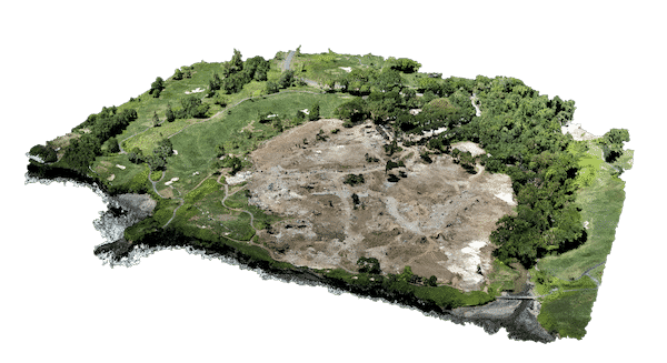
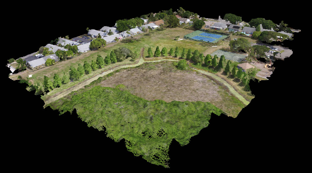
3D imaging is used to create a virtual model of a property. These models can be used for a variety of purposes, such as marketing, planning, and training.
3D imaging can be used to:
Market properties:
3D models of properties can be used to market properties to potential buyers or renters.
Plan construction:
3D models of construction projects can be used to plan construction and to communicate with clients.
Train employees:
3D models of equipment or processes can be used to train employees.
If you're a real estate agent, a construction company, or a training organization, you should consider using 3D imaging to help you market your products or services, plan your projects, or train your employees. 3D imaging is a valuable tool that can help you save time and money.
Additional Information
Our drone services offer efficient and accurate surveying and mapping solutions for a wide range of industries. By utilizing advanced aerial technology and sophisticated data processing techniques, we provide precise geospatial data that supports various surveying and mapping applications.
Drones equipped with high-resolution cameras and LiDAR sensors enable us to capture detailed aerial imagery and 3D point cloud data of vast areas with exceptional accuracy. These data sets serve as the foundation for creating digital maps, elevation models, and orthomosaics that accurately depict the terrain, infrastructure, and natural features.
In the field of land surveying, our drones provide a cost-effective alternative to traditional surveying methods. They can quickly and efficiently collect data, even in hard-to-reach or hazardous locations, reducing the need for manual surveying and ensuring the safety of surveyors. By utilizing ground control points and advanced photogrammetry techniques, we generate precise topographic maps, contour lines, and cadastral surveys that meet industry standards and regulatory requirements.
Our drone-based surveying services are highly versatile and applicable to various industries. In the field of construction, we support site analysis, earthwork monitoring, and volumetric calculations. By conducting regular aerial surveys, we track the progress of construction activities, monitor cut and fill operations, and generate accurate measurements for material quantity estimation. This helps project managers stay on schedule, optimize resource allocation, and minimize costly errors.
For the agriculture industry, our drones assist in precision farming and crop monitoring. By capturing high-resolution imagery and utilizing multispectral or thermal sensors, we provide valuable insights into plant health, nutrient deficiencies, and irrigation needs. This information enables farmers to make data-driven decisions, optimize fertilizer application, and increase overall crop yield and quality.
In the field of infrastructure and utilities, our drone services support asset management, inspection, and maintenance. By conducting aerial surveys and inspections of roads, bridges, pipelines, and power lines, we identify potential issues, assess structural integrity, and monitor the condition of critical infrastructure. This proactive approach to infrastructure management helps reduce the risk of failures, optimize maintenance schedules, and ensure the safety and reliability of essential services.
Our surveying and mapping services also extend to environmental monitoring and conservation efforts. By capturing aerial imagery and utilizing specialized sensors, we assist in habitat assessment, ecosystem mapping, and monitoring of natural resources. This data supports environmental impact assessments, conservation planning, and management of protected areas.
By leveraging our drone services for surveying and mapping, industries can benefit from increased efficiency, accuracy, and cost savings. The use of advanced aerial technology and data processing techniques allows for rapid data collection, precise mapping, and detailed analysis. Whether it's land surveying, construction monitoring, agriculture, infrastructure management, or environmental assessment, our drone-based surveying and mapping services provide the geospatial data necessary for informed decision-making and successful project outcomes.
Follow us
©Copyright 2023 Florida Drone Pros. All Rights Reserved